Whole continent
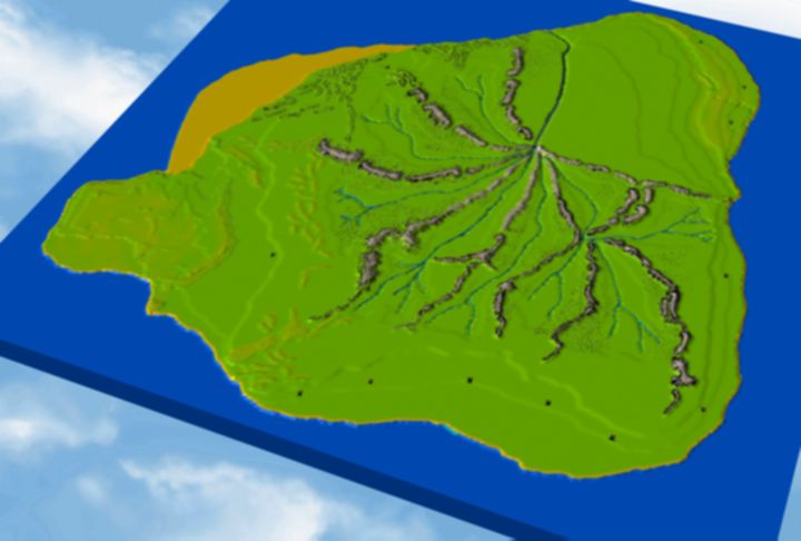
This one shows the whole map in its current state of completion.
I have sculpted it to give an indication of where present day land
masses are, such as Australia and Western North America. The vertical
scale on this map is stretched, to make the topography more visible.
In reality, if you plotted this map out on letter size paper,
the highest peak would only be about 1 millimeter off the page.
I can adjust the scale to any amount and should try that when zooming in closer.
Home | The Lemuria Mailing List |
FAQ
Maps of Lemuria
Lemuria Books | Lemurian
Resources | Links